
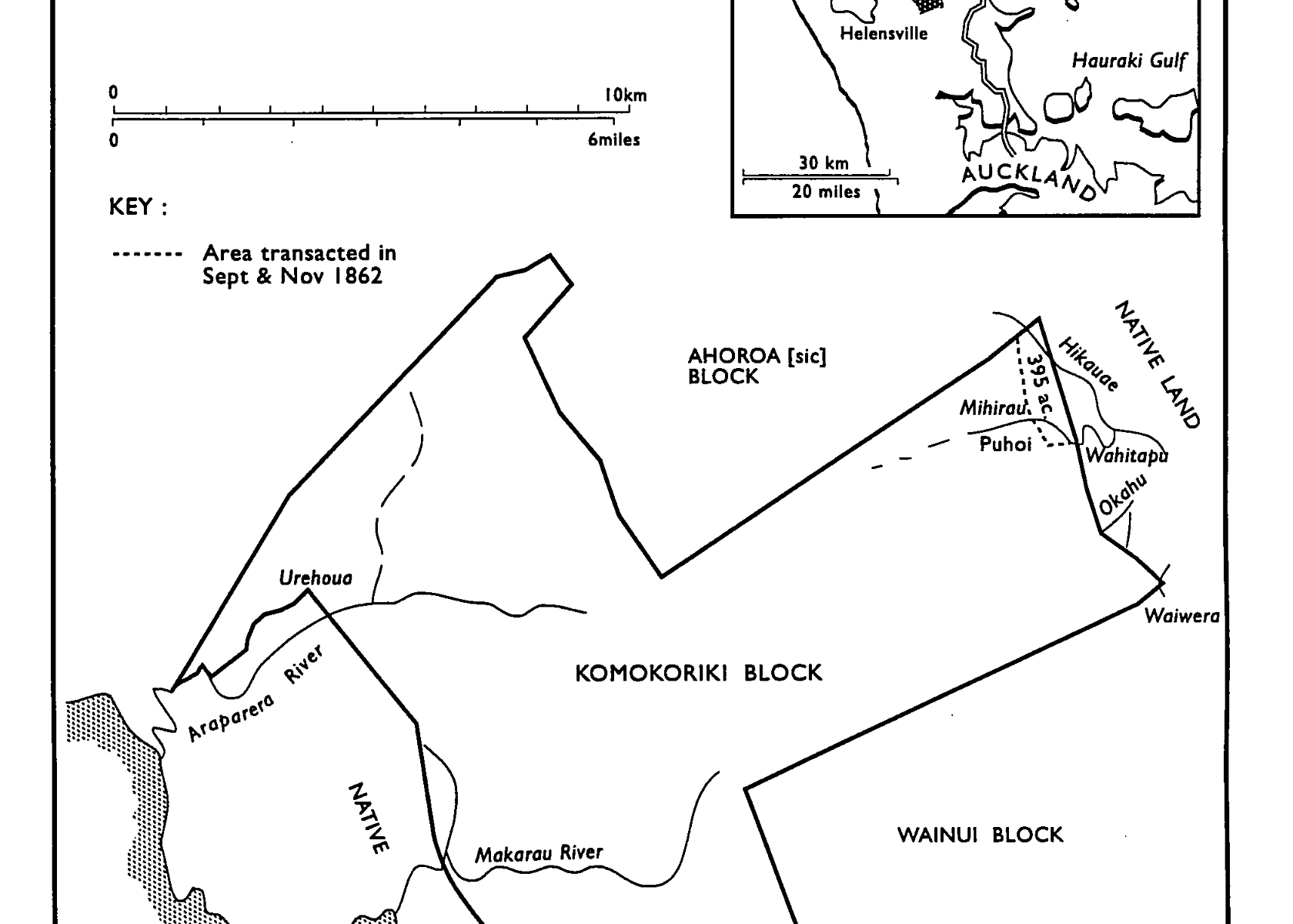
Northwest of us – about 15 kilometres – lies Komokoriki Hill Road. On the old maps that’s on the northern edge of the old Komokoriki Block. We are on the very southern edge of this Block. This area between the Ahuroa Block and the Wainui Block was bought by the Crown in 1862 from Ngati Rongo Chief Hemara Tauhia. Ngati Rongo is a hapu of Ngati Whatua o Kaipara. Hemara Tauhia and his iwi lived on the east coast, around the peninsula and headland of what is now, Wenderholm. Tapu burial caves, now hidden are said to hold the sacred remains of the people who lived and died there, before the Pakeha.
Our land is towards the end of a small tributary that drains our valley into the upper reaches of the Waiwera River. I’m not sure at what point we decided to call the farm Komokoriki Farm, but it may have been soon after we discovered this link to the original Komokoriki block.
You may or may not believe in ghosts or spirits. I have an open mind. A few days after we moved into our new home here in 2014, I encountered a Maori warrior, dressed in traditional warrior attire in the hall. Not a man as such, almost like a phantom. He was walking towards me and disappeared. In my surprise, I uttered “Tena Koe” … it happened so quick and he was gone so completely, that I hardly believed it, but the memory of it is vivid.
Maybe Hemara Tauhia still roams this Komokoriki Block of land, watching over it for his ancestors and descendants.
The map of the Komokoriki Block is from an historical report commissioned by the Waitangi Tribunal (Barry Rigby, August 1998) entitled, “The Crown, Maori and Mahurangi 1840 – 1881”. (WAI 674 F001).